In the complex world of urban infrastructure, the seamless functioning of a city largely depends on an often-overlooked hero – its sewer system. Understanding sewer condition and location is more than a technicality; it’s a critical factor in ensuring efficient wastewater management, especially as it relates to Capital Improvement Planning (CIP). At RedZone Robotics, we harness the power of Multi-Sensor Inspection (MSI) technology to offer comprehensive solutions for sewer challenges.
Understanding Sewer Alignment: A Key to Urban Infrastructure Efficiency
In civil engineering, comprehending the exact layout of sewer systems is vital. Sewer alignment is not only encompassing the direction, depth, and slope of pipes, but how this pipe could be affected by other above and below ground infrastructure – especially new construction. Accurate sewer alignment information is crucial for effective maintenance, strategic expansions, rapid emergency responses, and ensuring stability of critical sewer components. The last thing a contractor wants to happen is inadvertently striking a major trunk or interceptor! However, achieving sewer alignment accuracy is a tricky task often with various technical challenges.
The Role of MSI in Demystifying Sewer Networks
At RedZone Robotics, our Multi-Sensor Inspection (MSI) platforms collect synchronized sensor data such as LiDAR, Photogrammetry and IMU (Inertial measurement unit) sensors, which are vital technologies when determining sewer locations in real-world space. After all, it can be difficult to identify location on the surface when these pipes are underground! However, it’s important to acknowledge that MSI technology, while powerful, is not a “silver bullet.” LiDAR and Photogrammetry provide detailed three-dimensional mappings and visualizations, and the IMUs offer valuable data on the positioning of inspection equipment, but neither of these technologies can single-handedly guarantee absolute accuracy on their own; it is vital that knowledge of the sewer network plays a role in accurate sewer alignment.
The complexity of sewer networks, coupled with the limitations of even the most advanced inspection technologies like LiDAR and Inertial Measurement Units (IMU), highlights that calculating accurate sewer alignment within a few feet is not always a straightforward task. Global-Positioning Systems (GPS) and other wireless devices are no good underground, especially over the long distances these pipes traverse.
How Accurate Can We Get? The Crucial Role of Preparation and Knowledge
Since there isn’t a one-size-fits-all technology solution for each sewer alignment project, the importance of project planning work becomes vital. A fundamental part of this preparation is having a solid understanding of the surrounding sewer network for the project, particularly the location of trunk mains, interceptors, and access points. Knowing where these key components are located within the network is crucial for guiding the inspection process and interpreting the data collected effectively, ultimately providing a more accurate sewer alignment.
Sewer Alignment Deliverables
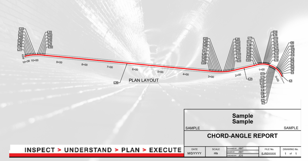
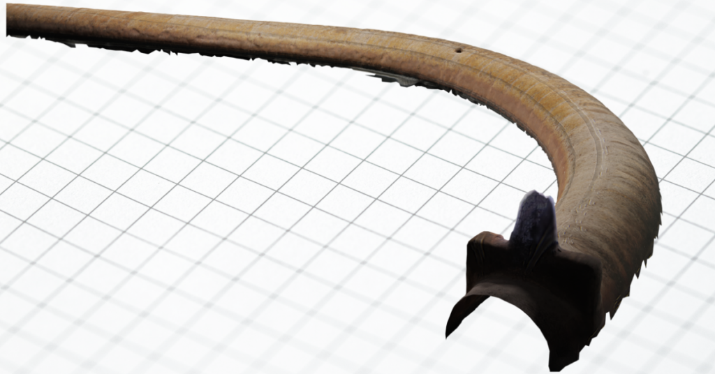
In sewer alignment projects, several essential deliverables are key to ensuring a thorough understanding and effective management of the system. One of the primary deliverables is detailed alignment maps, which are often integrated with Geographic Information Systems (GIS). LiDAR and Photogrammetric data produces 3D models, which can be linked back to the GIS at the access points – the connection to the above ground surface. With this connection, a comprehensive visual known as a ‘digital twin’ can provide key context for the integrity and location of the pipeline. Additionally, updated or new as-built drawings are produced to reflect the current state of the sewer system accurately if sizes or shapes vary from what is expected.

Applications of Sewer Alignment Information
Understanding sewer alignment is not just about identifying the current state of a sewer network’s infrastructure but also about leveraging this crucial information for a variety of strategic, operational, and compliance-related activities. Precise sewer alignment data plays a pivotal role in numerous aspects of urban planning and maintenance, enhancing both the efficiency and effectiveness of municipal services. Here’s how this information can be put to use:
- Infrastructure Maintenance and Repair:
Sewer alignment information is critical for planning and executing maintenance and repair operations. Knowing the exact layout and condition of sewer lines helps in pinpointing areas that require urgent attention, thereby preventing minor issues from escalating into major problems. It allows for targeted interventions, minimizing disruption and optimizing resource allocation. - Capacity Planning and System Upgrades:
As cities grow, so does the load on their sewer systems. Detailed knowledge of sewer alignment helps engineers and planners design system expansions and enhancements that accommodate increased demand. This information is crucial for capacity planning, ensuring that upgrades are both effective and economical, and that they integrate seamlessly with existing infrastructure. - Emergency Response and Mitigation:
In the event of blockages, leaks, or other emergencies, immediate access to accurate sewer alignment data is vital. It enables quick response actions, helping to mitigate damage and restore service more rapidly, as utility operators know exactly where to begin work. This information is particularly valuable in managing incidents that could pose environmental or public health risks. - Compliance with Environmental Regulations:
Many regions have stringent regulations governing wastewater management to protect water quality and public health. Sewer alignment data helps municipalities ensure that their systems comply with these regulations by facilitating thorough inspections, proper maintenance, and accurate reporting of system status and incidents.
Getting Started with RedZone Robotics for Sewer Alignment
Understanding and maintaining the precise alignment of your sewer system is essential for efficient operations and long-term infrastructure management. Partnering with RedZone Robotics is your first step towards ensuring that your sewer networks are not only well-maintained but also compliant with the latest regulatory standards and ready to meet the challenges of tomorrow. Here’s how you can get started with RedZone Robotics to leverage their expertise in sewer alignment determination:
- Initial Consultation:
Begin your journey by reaching out to RedZone Robotics for an initial consultation. During this meeting, you can discuss the specific challenges and needs of your sewer system. RedZone’s team of experts will help you understand the various services and technologies they offer that can address your concerns, particularly focusing on how their innovative solutions can enhance your sewer alignment accuracy. - Customized Solution Development:
Based on your specific requirements and the complexities of your sewer network, RedZone Robotics will develop a customized solution tailored to your needs. Whether it involves deploying advanced autonomous inspection robots, integrating GIS data, or utilizing sophisticated analytics platforms, RedZone ensures that the solution not only addresses your immediate alignment concerns but also positions you for future enhancements. - Implementation and Data Collection:
With a plan in place, RedZone Robotics will begin the implementation process, deploying their state-of-the-art technology to collect detailed data about your sewer system’s alignment. Their autonomous robots and sensors are designed to navigate through sewer lines efficiently, providing high-resolution imagery and precise data without disrupting your system’s operations.
Take the first step towards a smarter, more resilient sewer management strategy. Partner with RedZone Robotics and set your utility on the path to success.


