

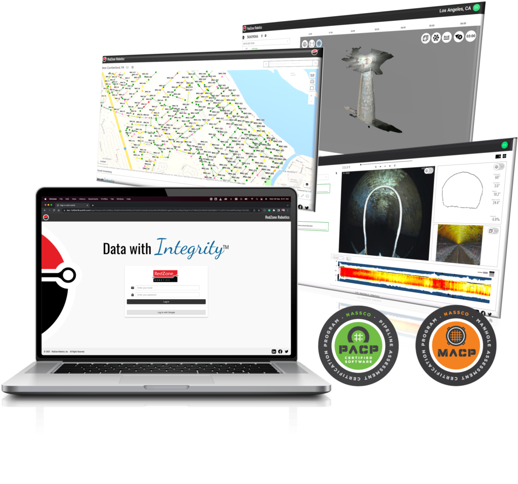
Integrity™ is a cloud-based inspection viewer and sewer management software, designed to keep your inspection data and projects right at your finger tips.
From manipulating crystal clear 3D models to reviewing every inch of your laser and sonar results, Integrity is the best way to analyze all assessments of your collections system. Use the ESRI-based mapping tools to see your entire system or zero in on assets based on their NASSCO defect scoring. View and export asset condition reports with the click of a button and much more.
Integrity takes your inspection data from accessible to actionable.
MSI
Integrity is the only place where you can view data from all of RedZone’s advanced multi-sensor inspection platforms. Now you can evaluate and review Multi-Sensor Inspection results – laser, sonar, and gas – right alongside the CCTV and NASSCO Scoring.
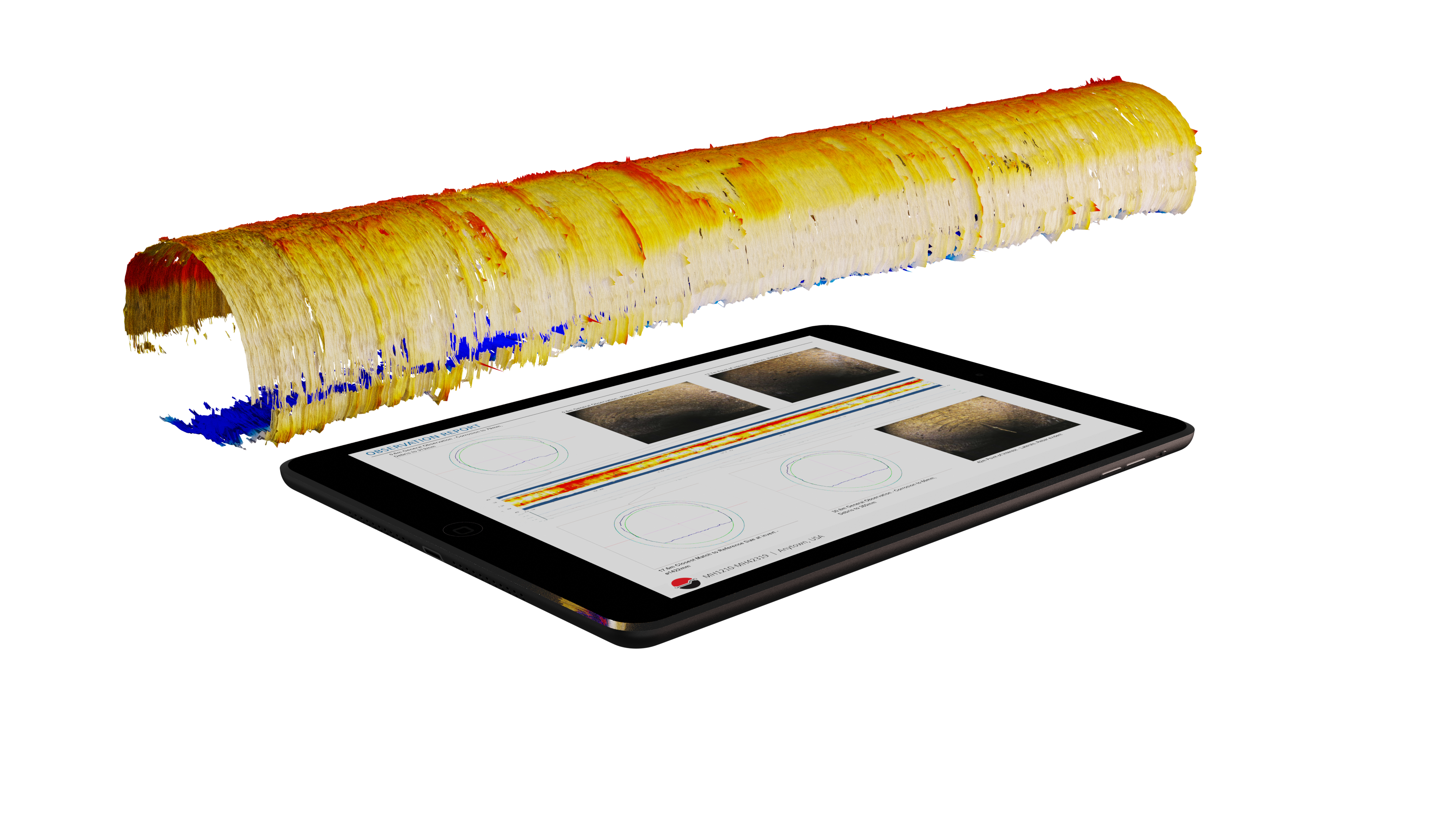
From Sonar Debris Graphs to Laser Cross Sections, MSI quantifies what you can and cannot see from a standard video inspection.
Synchronized data, enabling you to obtain the whole view of the pipe at any given location.
The same heat mapping visualization that pioneered MSI data reporting, is present.
Introducing photogrammetry, new sensor technology and data utilized by Redzone’s Vertue™ and Profiler 3D™ robots.
Manipulate 360-degree videos, and high-fidelity point cloud models in the browser.
Ready to get started? Connect with us today!
Complete this form to schedule your next advanced pipeline assessment & sewer inspection, get a quote, or connect with a RedZone Robotics team member.
Want to know how RedZone Robotics helps you to reduce your CARBON BOOTPRINT? Click here to learn more!